software
We develop and sell following products.
TopoL xT
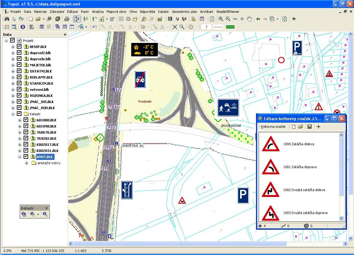
TopoL xT
TopoL xT is general GIS, which can be used in many areas. It enables to collect, update, analyze and manage geographical data.
TopoL xT can process both vector and raster data equally well and provides wide scale of vector and raster data manipulation and analysis methods.
Digitising capabilities of TopoL xT are easy to use and the system is able to solve topologic relations in real-time while data are digitised.
TopoL xT can import and export data in many industry-standard formats. TopoL xT is running on standard PC computers in MS Windows environment. Czech, English, German, Italian, Spanish and Russian language mutations of the system are available.
TopoL Mobile
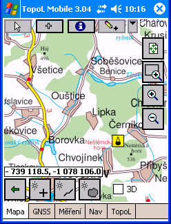
TopoL Mobile
TopoL Mobile TopoL Mobile is cheap and simple GIS solution for field data collection and navigation with GNSS. It runs under Windows CE, Mobile operating systems on Pocket PC.
It has very intuitive user interface that requires no training.
TopoL Mobile can display both vector and raster data. Number of layers is not limited.
New points, lines and polygons are saved in ArcView shapefile, dxf format and as ASCII file.
This system can be applied in solving a number of tasks in many areas. Magistrate Hradec Kralove for tracking phone booths and any other objects in the city.
Farmers measure area size of their fields. These values are then used in completing grant applications.
PhoTopoL
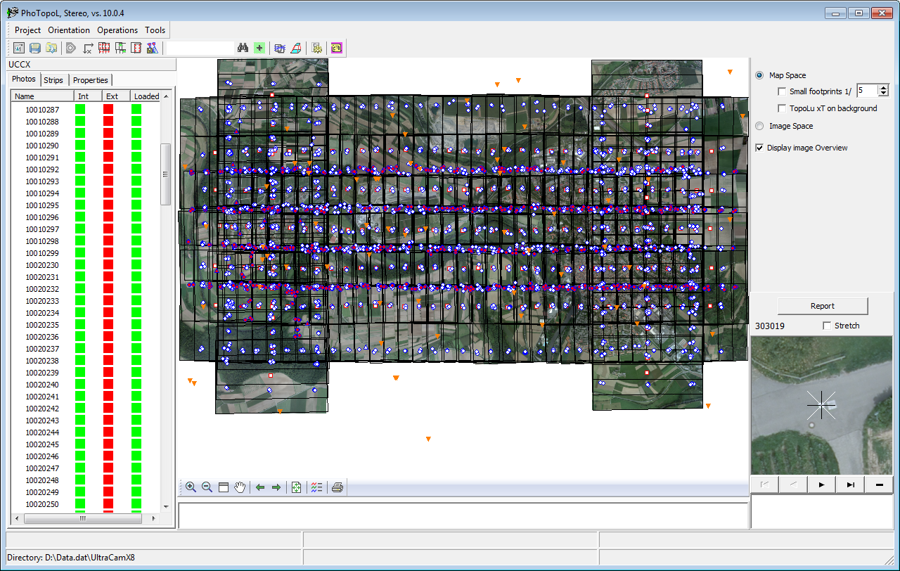
user interface of PhoTopoL
PhoTopoL is a powerful application to process photogrammetric and GIS data. It includes the modules for aerial triangulation, stereo editing, orthophoto rectification and mosaicking with color balancing.
This system is used in many areas.
Czech surveying institude uses the program PhoTopoL to update ZABAGED (Topographical maps of the Czech Republic). In this work it is possible to view in stereo mode aerial images, vector lazers and data acquired by laser scanning in the same time.
Doly Bilina process mining maps in TopoL xT. They use PhoTopoL to calculate aerial triangulation and to make orthophoto maps. PhoTopoL Stereo View is used by managers to check digital terrain model, which is calculated each month.
TopoL Internet Server
TopoL Internet Server is a complete system for publication of spatial data in Internet/Intranet environment.
Katastr
Katastr is application of TopoL xT. It works with Czech cadastral data. Please contact us for more information.
AeroTopoL
AeroTopoL is software solution for mission planning and flight management for aerial imaging.
KPÚ
KPÚ is application of TopoL xT. It is used for land management in Czech Republic. Please contact us for more information.
TopoL-L
TopoL-L is the application of TopoL xT and it is used for Forest Management Plans creation in Russian Federation.